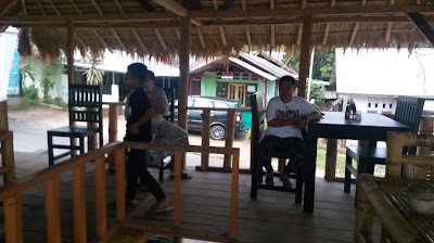
About MOUNT RINJANI ULTRA
MOUNT RINJANI ULTRA is a park
MOUNT RINJANI ULTRA is an ultra trail running event scheduled on 17 August 2013 at North Lombok, West Nusa Tenggara, Indonesia.
Tags
The race starts from Senaru (600 masl) through dense forest vegetation with ground track along the 8.5 km and next 2 km will cross rocky hill with views of the savanna in along the way to Plawangan Senaru.
At sunrise, when you reaching Plawangan Senaru (2600 masl) you will enjoy the stunning panorama of Lake segara anak and Summit of Rinjani in the distance.
The following route is down the hills into steeply rock boulders whit ground track ground interspersed pine vegetation along the 3 km to Lake Segara Anak.
From Lake Segara Anak (2000 masl) towards Plawangan Sembalun (2600 masl) you will enjoy running at the edge of the Lake with a track stones and you will be presented with a beautiful view of the light reflection along the 3 km hills while crossing the weed and grass with a land track. Boulder rock and incline steep is along the way 1 km ahead of Plawangan Sembalun.
Reaching Plawangan Sembalun, you will see a wonderful landscapes facing lakes, Mount Rinjani peak and Sembalun village’s surrounded hills.
The real challenge and the heaviest part of this race are 5 km away to the top of Rinjani (3726 masl), starting with solid sand track with the tilt angle of gentle incline ramps, then passes through a thick and depth smooth sand track, changed to solid sand track and gravel. The last 2 km towards the Summit, around above elevation 3400masl you will be challenged to climb the Summit of Rinjani with mixed between sand and gravel track that is quite deep to submerge your step (approx. 15 cm). This part of the racetrack will be tougher especially if the wind was blustery and foggy.
At the nice and clear weather when reaching and standing at the dense sandy rock plate about 4 x 12 square meters at the top of Rinjani you can see magnificent and beautiful panorama of Rinjani region, you will be able to see clearly the views of Lake Segara Anak and the incline black yellow and red path you are recently going through. And you will be able to see Bali's highest mountain Gunung Agung (3142 masl).
The route will bring you down from the Summit back to Plawangan Sembalun regions, and you will be faced with a challenge as well as the sensation of running on the decline sand in steep slope and the other side you will enjoy sliding like sledding above the snow but on the other hand it is endanger ourselves. Dangerous because the tracks that you are going through very narrow between 1.5 m to 4 m and on the left and right side is deep ravine.
Upon Plawangan Sembalun regions you heading to Pos 2 (1500 masl) you down the hill with moderate dense of pine vegetation and you will be treated to panoramic views of the hills of the beautiful savannas colored golden yellowish.
From The Pos2 then you have to go back to the previous route to return to Senaru.